


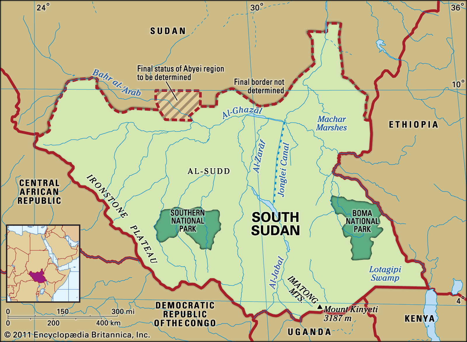
South Sudan is a landlocked country in East-Central Africa, and it shares borders with six countries. Here’s a breakdown of its international boundaries:
Borders of South Sudan
| Country | Direction | Approximate Border Length |
|---|---|---|
| Sudan | North | ~2,158 km |
| Ethiopia | East | ~1,297 km |
| Kenya | Southeast | ~317 km |
| Uganda | South | ~435 km |
| Democratic Republic of the Congo (DRC) | Southwest | ~628 km |
| Central African Republic (CAR) | West | ~682 km |
Key Border Regions and Disputes
- Abyei Region(with Sudan):
- A highly contested area between Sudan and South Sudan.
- Rich in oil and grazing land.
- Status unresolved; under temporary UN administration (UNISFA).
- Kafia Kingi and Heglig Areas(with Sudan):
- Also disputed; both areas are resource-rich and strategically important.
- Ilemi Triangle(with Kenya and Ethiopia):
- Tri-border area claimed by South Sudan and Kenya.
- Administered by Kenya, but also claimed historically by South Sudan.
Border Crossings
Major border towns and crossings include:
- Nimule (with Uganda) – busiest crossing, key trade route.
- Renk (with Sudan) – northern gateway.
- Nadapal (with Kenya) – smaller but strategic for Eastern Equatoria.
- Pagak (with Ethiopia) – historically used for trade and movement.


